Project update
The Start of Something — The Peripheries
Published
Ten parks, two far edges of San Francisco, and one plate of tacos turned a quiet idea into a fieldwork routine I wanted to keep following.
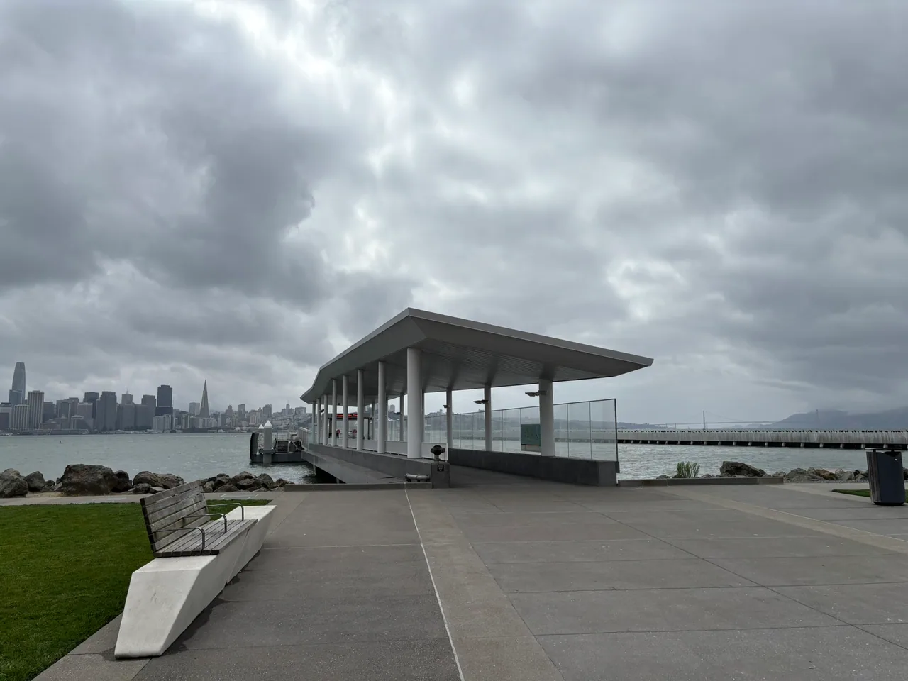
The waterfront pavilion and skyline view at Treasure Island Landing.
Every new project begins as a quiet hypothesis. Mine was that San Francisco's park data could become more useful if I gave it some human context—not by inventing anything, but by going to the places myself, taking photographs, and paying attention to what the database could not tell me.
That was the idea behind Baker Parks, the custom spatial layer that became SF Parks Explorer. On a screen, it sounded sensible. The only way to find out whether it worked was to leave the screen behind.
So I planned an unnecessarily ceremonial first outing: ten sites in one day, beginning on Treasure Island and Yerba Buena Island, then crossing the city to Lake Merced and Pine Lake Park before the light disappeared. Two watery edges of San Francisco, separated by a lot of roadway. It seemed like a good place to begin.
Out to the islands
Treasure Island on a quiet weekday has a particular stillness. There were maintenance workers here and there, but few other people. The island did not invite the usual San Francisco rhythm of stopping for coffee, wandering into a shop, or turning a park visit into an afternoon of errands. There was not much nearby to distract from the assignment: keep moving outward and see what was actually there.
Cityside Park was fairly simple as a collection of built features, but the view was anything but. Downtown San Francisco appeared across the water without much standing in the way. From there, I continued past the old naval buildings and along the trails near Clipper Cove.
The map made the island parks look close and orderly. The ground told a different story. Moving onto Yerba Buena Island introduced a sudden climb, with the high point and its public sculpture sitting well above the flat grid I had just left. Down near the eastern base, another small public space felt almost tucked behind the island's military history. It was isolated and quiet, with open water between me and the East Bay.
This was exactly the kind of context I had hoped to find. The records could identify parks, paths, lawns, and public art. They could not explain how dramatically the terrain shifted, how empty the spaces felt on that particular weekday, or which view made a modest park memorable.
The photographs began teaching me what the collection needed. The best image was not always the grandest one. Sometimes it was the photograph that showed the scale of a lawn, the direction of an overlook, the character of an entrance, or how one space connected to the next.
Across town before sunset
Once I had worked my way through the island list, I crossed San Francisco toward Lake Merced. The contrast was immediate. Treasure Island had felt sparse and windswept; Lake Merced was busy. High school rowing teams were practicing on the water, people were moving through the park, and the sporting infrastructure gave the shoreline the energy of an active civic facility.
Lake Merced is the sort of place that looks important in the data. It is large, full of features, and difficult to represent with one photograph. In person, though, its less glamorous realities were just as noticeable. Traffic runs close to the opposite shore, creating a steady visual and acoustic backdrop to the water. A useful guide should have room for both impressions: this is a substantial public recreation space, and it is not a secluded wilderness.
After the lake, I worked through several nearby neighborhood sites and reached Pine Lake Park. The entrance had proper municipal signage, but it was subtle enough that I could imagine passing it without realizing what was below.
The path descended into a valley and the city seemed to fall away with it. At the bottom was a hidden lake edged with vegetation, familiar park amenities, open lawn, and an enormous canopy of mature trees. Stern Grove next door is well known for its summer concerts. Pine Lake and the surrounding non-concert landscape felt like the quieter discovery: a substantial place hiding behind a residential street.
Ten parks and a plate of tacos
By the end of the day, I had crossed the first ten parks off the list. I had also learned that the fieldwork would involve much more than pointing a camera at whatever looked attractive. Each visit required navigation, observation, changing light, and enough organization to identify everything later. Back at the computer, every selected image would still need a destination, a sequence, a caption, useful alternative text, creator credit, and a delivery record.
None of that was especially glamorous. The celebration was: a plate of fancy tacos at a local Mexican restaurant before getting back on the highway to the East Bay.
The outing did more than produce the first batch of photographs. It established the cadence that would carry the project forward: plan a route, walk the sites, document the obvious and the easily missed, return to the data, and see what the real place had exposed.
The hypothesis had survived contact with the ground. Better yet, I wanted to do it again.